A closer look
One mile, and three kilometres, kept apart
Later official pictures do not cancel the 1976 caption. They add new official wording, and at least one new official size, and they are kept here as themselves.[source][source]
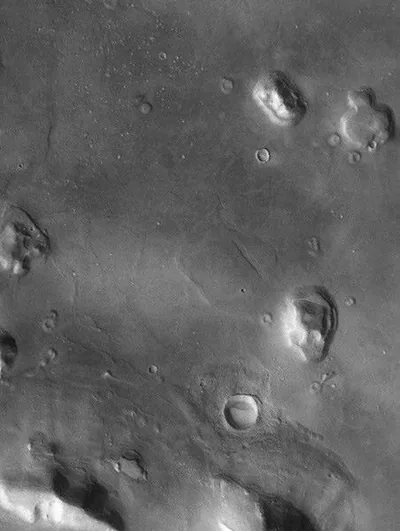
A THEMIS visible image, released 13 April 2002, is officially titled “The So-Called ‘Face on Mars.’” “The so called ‘Face on Mars’ can be seen slightly above center and to the right in this THEMIS visible image.” Official wording then gives a figure this site does not blend with the 1976 mile: “This 3-km long knob, located near 10° N, 40° W (320° E), was first imaged by the Viking spacecraft in the 1970’s and was seen by some to resemble a face carved into the rocks of Mars.”[source]
What did later cameras show, officially? Mars Global Surveyor’s Mars Orbiter Camera, the same official caption says, “has provided detailed views of this hill that clearly show that it is a normal geologic feature with slopes and ridges carved by eons of wind and downslope motion due to gravity.” A NASA Science blog later adds another official sentence: compared with a Mars Global Surveyor 2001 image, “the landform only appears to resemble a ‘face’ in low-resolution images with very specific lighting.” The blog also calls it “an eroded mesa covered in dust and ice.”[source][source]
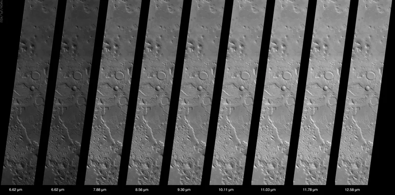
An official infrared view, PIA03905, released 24 July 2002, steps back. The THEMIS infrared camera, official wording says, covers “an area 32 kilometers (~20 miles) by approximately 200 kilometers (~125 miles).” In that “big picture” view, Cydonia “is seen to be covered with dozens of interesting knobs and mesas that are similar in many ways to the knob named the “face” — so many in fact that it requires care to discover the “face” among this jumble of knobs and hills.”[source]
The official infrared caption locates the landform “near 40° N, 10° W (350 ° E).” The official visible THEMIS caption locates the 3-km knob “near 10° N, 40° W (320° E).” Those official coordinates are not the same. This site keeps both, and does not quietly correct one with the other.[source][source]
Many of the knobs, official wording says, including the “Face,” have flat ledges partway up the slopes — “more resistant layers of rock,” “the last remnants of layers that once were continuous across this entire region.” “Erosion has completely removed these layers in most places, leaving behind only the small isolated hills and knobs seen today.”[source]
Enjoyed this desk of faces that are not there?
No pop-ups. No intrusive advertising. Just interesting stuff. A little support helps the next illusions.im site get built.